In the "good ol' days," before smartphone digital apps directed us along precise routes to our destinations, we had digital maps we could view using MapQuest or Google Maps or some such web-based system (using our laptops or desktop computers). Some of us remember the even further-back "gooder ol' days" (apologies for being ungrammatical for the sake of a laugh) when people used paper maps. You know, the kind that you'd unfold, stare at blankly, then struggle to refold correctly.

Perhaps paper maps have gone the way of the dinosaurs, but they can be valuable historical documents, as they're a snapshot-in-time of the way a place used to look (at least on a map). There are old streets that may no longer exist or have been renamed. Routes may have changed, or new highways constructed. Advertisers place the map in time, too.
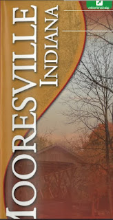
The Mooresville Chamber of Commerce produced a paper map that they distributed (ca. 2005) that shows Mooresville, Indiana as it looked then. There are a few copies floating around, but we've digitized one so you can see it online. Click the image below.
No comments:
Post a Comment
Note: Only a member of this blog may post a comment.